At Surveying Cymru our drone pilots have all the qualifications needed for not just open, but specific operations. Jak Dargie, Chief Drone Operator is qualified with an A2CofC as well as a GVC which means that he operates to the highest standards and is constantly staying up to date with new regulations.
Surveying Cymru uses technology to offer construction professionals alternative visual options, enabling them to work smarter. Drones offer us safer alternatives to external work and working at height. Surveying Cymru has drones for every task, whether you require highly accurate footage, site progress monitoring or even great imagery, we can deliver it all using the latest photographic software.
Using a drone allows us to reach heights never before possible and survey parts of your building that would only have previously been accessible via dangerous work at heights. Not only that, using a drone, certain tasks can be completed by just one operative, where other solutions may require many people on-site to safely carry out the data gathering.
While on-site, we are able to carry out surveys of large areas quickly. Our drones can cover many acres in a single day if required. Data can be collected and processed in short time frames, with high-quality data collection. A roof survey for large commercial sites can take many weeks to complete with traditional methods, using drones we can have a turnaround time of fewer than 48 hours, including taking of and analysis of the footage, to delivering the results.
WHAT OUR CLIENTS SAY
Safety
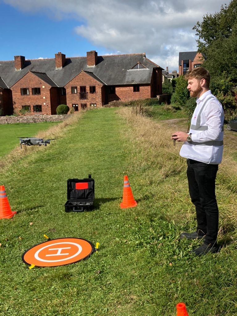
Flying Drones Safely is our number one concern.
Before we fly our drone our operators will conduct a full risk assessment of the area to be surveyed. This will always be brought to the site as well as a method statement and task review.
If it is unsafe to fly we will not attempt a survey.
Quality
There are varying degrees of Drone Operations.
We do not just specialise in property and land surveys; we can also produce video footage or purely just aerial photography.
You can be confident in our quality and commitment to using the latest technology.
Data Accuracy
Not many Drone Surveyors will commit to an agreed level of Data accuracy. We do.
This should be a crucial purchasing decision for you.
Accurate data can help you identify issues that can result in losses, save money and help you benefit from the data we’ve produced.
Within 48 hours of your survey you will receive your requested Data (raw footage or edited if requested.)
Contact Us
If any of these fore mentioned services appeal to you or someone you know then please don’t hesitate to get in touch for a quotation or just a chat about the job at hand.
You can contact us at: jak@surveyingcymru.co.uk
Or alternatively give us a call on: 07807 579678
What we need from you and terms and conditions
Our drone aerial photography pricing may vary depending on the complexity, associated risks and location of the drone aerial photography. Please call or email us to discuss your plans and requirements.
Each job is unique and because all aerial photography drone flights are covered by CAA regulations we always carry out a detailed online Pre-flight survey before sending you a final quote.
Site Survey, Booking, Deposit and Timing
Remote pilot aerial drone photography and video is affected by the weather especially in the U.K. Therefore Surveying Cymru have a flexible and pragmatic approach to scheduling client work.
We cannot operate our drones in rain or high winds. Also clients may have specific requirements that restrict us to flying at specific times.
What We Need From You
The location of the shoot (with an exact postcode), proposed date and a brief containing as much background information as possible on what you want us to photograph and film.
Site Survey
We can then do an initial office based online site survey to see if the shoot is possible and if there are any other factors, flight restrictions or permissions that need to be considered.
In larger filming shoots the drone aerial photography may be a small part of an overall production. However in order to comply with the terms of our CAA license we still need to complete our pre-flight survey. This could involve a physical site visit.
Each job is unique with a mixture of external influences that can affect when and where we can film, but we plan ahead to decrease possible disruptions.
Booking & Deposit
We can then do an initial office based online site survey to see if the shoot is possible and if there are any other factors, flight restrictions or permissions that need to be considered.
In larger filming shoots the drone aerial photography may be a small part of an overall production. However in order to comply with the terms of our CAA license we still need to complete our pre-flight survey. This could involve a physical site visit.
Each job is unique with a mixture of external influences that can affect when and where we can film, but we plan ahead to decrease possible disruptions.
Weather
We monitor the weather forecast 5 days in advance of any shoot. If the signs are not good we talk to the client 48 hours prior to the shoot.
At this point we will reschedule the shoot to the next suitable date at no additional cost and the booking deposit is transferred to the new date. Weather is a know business risk in the UK, so we have to be as flexible as possible to ensure that bookings can be rearranged.
If the shoot cannot be re-scheduled due to factors out of our control (live events, client availability) Surveying Cymru do not offer a refund of the initial deposit.
If we both decide to stay with the original date and we have bad weather, our pilots will wait on site as long as possible in the hope of a break in the weather.
If we arrive on site and are unable to shoot on the day we will charge in full, but offer clients a 25% discount off the price of the second shoot on the follow up date.
Cancellation
If the client cancels the shoot within 7 days of the scheduled date the 25% deposit will not be refunded.
Copyright and Use of Material
Surveying Cymru retains the copyright of all aerial photography and filmed content.
We can negotiate and agree a buyout of footage for specific filming contracts.
Our clients have full use of all photography and filmed material for their own business promotion, media, print, marketing, advertising and website use. In our terms of service clients are permitted to use all material in conjunction with their media, print and advertising suppliers.
Clients are not permitted to sell the material or allow general 3rd parties to use it with prior written agreement with us.